


JudithWhiteGIS.com
About
We all can now search the earth's surface for unique and interesting geological formations.
Sometimes, we may find something special.
My Mission
- To visualize and research our complex and mysterious world.
- To share the findings with others.
- To inspire curiosity and wonder.
- To sponsor related dialogue.

1772 - Plano Geográfifico de la mayor parte de la America Septentrional Española, Digital Commons @ CSUMB
Eagle Geoglyph: Aztec Symbol of Mexico
Judith Esparza White
History
The historic legend of the Aztec people foretold that their city, Tenochtitlan, would be located where they would find an eagle sitting on a cactus, on a rock, and near a lake. This physical eagle was found and the city was created.
Since the Aztec and the Mixtec people, who had tens of thousands of warriors, were divided and warring with each other, “Divide and Conquer,” was all the Spanish had to do when they had only 400 soldiers who battled fiercely against the masses of Indians. According to Bernaz Diaz del Castillo, one of Hernan Cortes men, talk of negotiating peace while befriending the warring Mixtec groups, against their Aztec enemy from time immemorial Moctezuma, worked well. The Aztecs also mistook the conquistadors for “teules” or gods, which helped lead to their downfall.
After the killing of Moctezuma II, Emperor of the Aztecs in 1520, and the Spanish conquest, the city was later given the name of Mexico City by Hernan Cortes. The book, The essential Codex Mendoza, mentions an origin myth of the ancestors traveling from the “distant northern deserts."

Fig. 1 - The Founding of Tenochtitlan, Folio 2r,
The Essential Codex Mendoza, 1541.
The image of the eagle was embraced by the Mexican people when they fought to gain their independence from the Spanish. It appears on many flags and as a symbol throughout Mexico.

Fig. 2 - The Churubusco flag symbol, 1847.

Fig. 3 - The 1823-1867, 1867-1893,
Mexico Flag symbol.
Geological Formation
This image shows the outline of an eagle with hooked beak, brow ridged eye, crown of the head, arched wings, body, cactus with flowers, and the left talons hold a snake. This is an actual geological pattern made of low mountains, mesas, rivers, and arroyos.
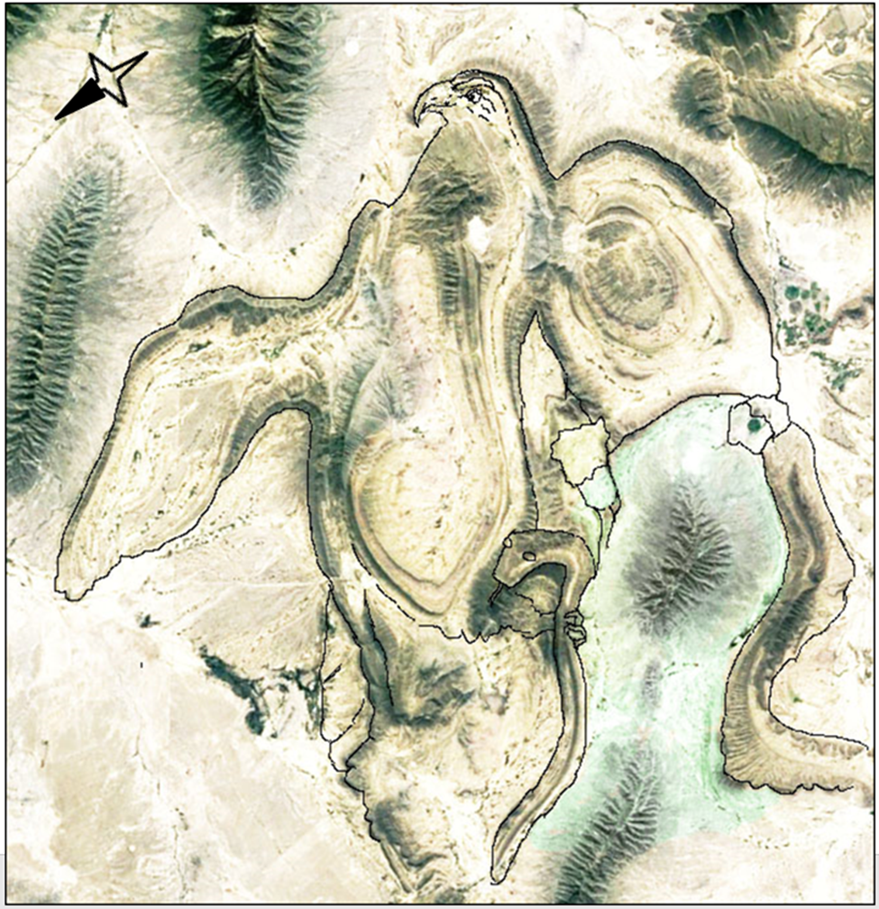
Fig. 4 - Outlined Using Adobe PhotoShop with Reduction of the Intensities
and Background, J. White.
Mexican Federal Highway 53 runs through the natural gap between two low arched mountain ridges on the eastern radius of the eagle’s right wing. Their height is listed as over 900 meters or 2,952 feet high. This road travels straight northwest through the expansive Tamaulipan thornscrub plains. It then traverses the excavated cuts in the parallel ridges of the wing's lower northwest border.
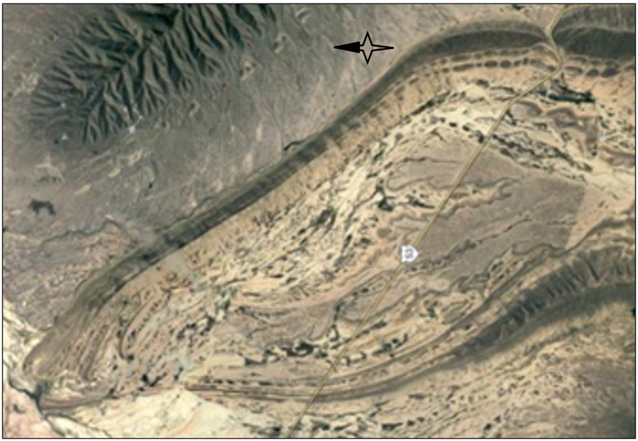
Fig. 5 – Right Wing with Highway, Google Maps

Fig. 6 – The Mexican Federal Highway 53gap through the Sierra el Rincon del Arco low arched mountains of the Right Wing,
approaching from the east, Google Maps.
A primary feathered pattern, which is made of curvedmesas and ridges, can be seen in the satellite image of the right wing tip.
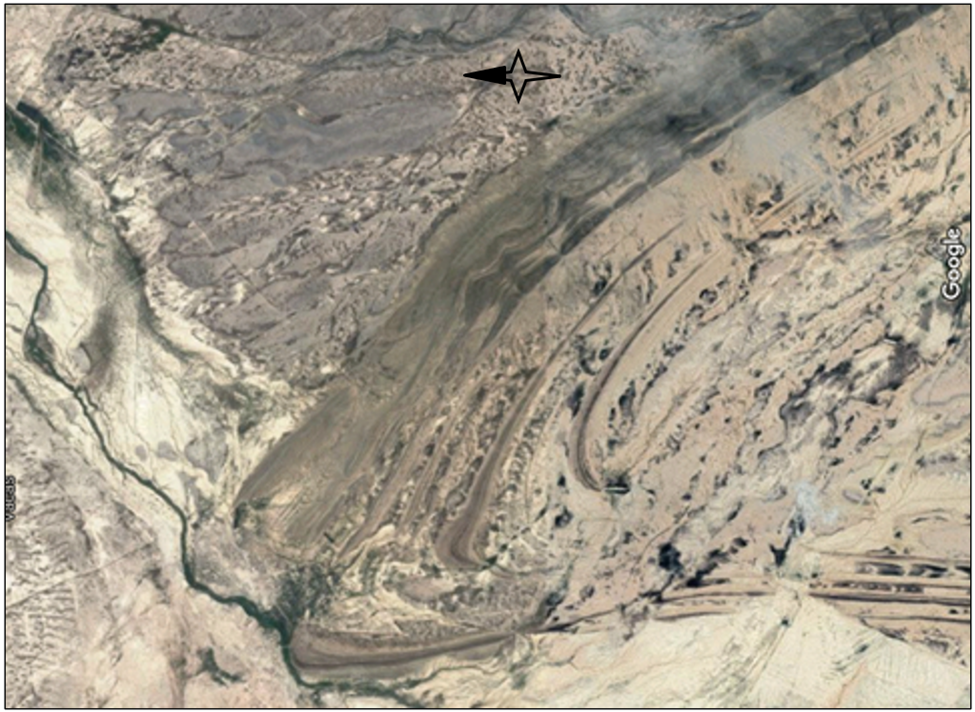
Fig. 7 – Right Feathered Wing Tip, Google Maps.
This high elevation tree-less terrain looks just as peculiar as the aerial pattern. There are many parallel low mountain ridges, spire-like rock outcroppings, rivulets, and eroded canyons.

Fig. 8 - Mina Region, Google Maps.

Fig. 9 - San Jose de la Popa Region, Google Maps.
Identification Reference
The Golden Eagle is the national bird of Mexico. This eagle ranges from mid Mexico to North America, and is also in the Northern hemisphere in Europe and Asia, north of the Tropic of Cancer which is at a latitude of 23.4372 degrees. This latitude line would circumscribe the earth about 186 miles or 300 kilometers directly south of this site. This is the hunting eagle used by the Altai Mountain cultures of the Eurasian Steppe Belt of Kazakhstan and Mongolia.

Fig. 10 - Golden Eagle.
Lineage Connection
This unique Eagle Geoglyph was located, using Google Earth, while I was reviewing the landscape in the region of our ancestor’s homeland. Our father’s paternal line is descended from the indigenous First Nations and the Spanish people of Mexico and New Mexico.
Our Esparza surname is connected to Moctezuma II through the Aguascalientes, Mexico, marriage in 1594, of his great, great granddaughter, Ana Francisca de Gabay y Moctezuma, to Lope Ruiz de Esparza on our paternal great grandmother's lines. We have many DNA cousins that have ties to this Aguascalientes family.
“These Ruiz de Esparza, which later established themselves in Aguascalientes and from there were linked to Teocaltiche, Nochistlan, Tepatitlan, Arandas and other highland territories were linked with the Romo de Vivar, Gabay, Tiscareño, Escoto-Tovar and other old families of the region, in so doing they have extended their bloodline in a way that today there is no highland family that does not descend in some way from them.”
NOCHISTLAN, ZACATECAS, his Parish,
Los Duran and other ancient families.
We also have many paternal line DNA cousins that have connections to the Apache families in New Mexico, Utah, Arizona, Oklahoma, Texas, and Mexico. This tie may be related to the Indian Wars which generated the kidnapping and adoption of Apache children into Mexican families.
Aerial Location
This Eagle geological formation was located a number of years ago, southwest of the U.S. border in a very remote, isolated, and high elevation region of Mexico. This might be called a "distant northern desert." It can be found a little northwest of Monterrey, Nuevo Leon, Mexico.
If a commercial plane was flying at a flight level of 6 miles high, or 31,680 feet, right over the geoglyph, the passengers might be able to see the bird outline on a bright day. A small plane pilot is not likely to see the defined pattern if flying at a flight level of 1 mile high, or 5,280 feet above the 36 mile wide bird shape. This high resolution satellite imagery, that can be accessed today, shows the whole area much more clearly.
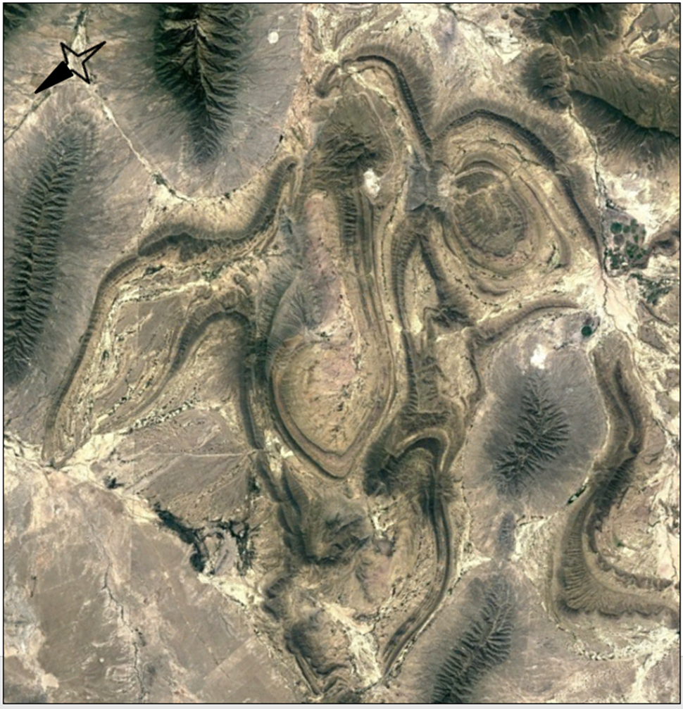
Fig. 11 - Eagle Geoglyph - rotated minus 125 degrees to be upright, Google Maps.
Geography
This Eagle Geoglyph has a very striking geological outline. The geographical name for the long serpent silhouette, with the eagle's left talons around it, is Filo Espinazo Del Diablo, which translates “the edge of the Devil’s spine.” The snake head is named Mesa El Capote, which translates, “the cape.” There are irregular geological patterns at the base of the eagle’s right claw which could be interpreted as a cactus perch with cactus flowers. The Mexican names that make up this pattern are the Mesa De Los Chinos “table of the Chinese,” Cuchilla Cervantes “blade of Cervantes,” and a mountain ridge called Sierra La Leona “mountain range of the lioness.”
The diameter measurement across this geological formation is approximately 57.9364 kilometers or 36 miles. The outline looks to be shaped by ordinary natural structures. There does appear to be some modern excavation, perhaps from farming furrows or mining pits, which has made some noticeable scars over the years. The roads show well defined linear marks with winding through the passes in the low mountains.
Technical Reference
Using the stretched 3-band continuous raster cell data with a gradual brown color ramp and the contours of the elevation in meter lines, we can see the snake head and cape more clearly. The crown of the head, beak, wings, body shape, and cactus is also defined.

Fig. 12 - Raster Cell Data with meter elevation contours shows definition, rotated 125 degrees to be upright, J. White.
Angle and Rotation of the Geoglyph
To visualize and review the Eagle Geoglyph image more easily, I rotated it 125 degrees so that it would be upright.
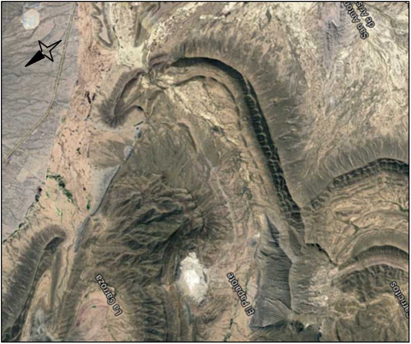
Fig. 13 - Eagle Geoglyph Head
rotated 125 degrees to be upright, Google Maps.
On the Google map compass orientation, the eagle’s beak is facing to the northeast with its talons pointing to the northwest. The eagle's head lies toward the southeast. This geoglyph is in a less accessible low mountain range basin, which is west of the peak of Cerro Tia Chena “Hill of Aunt Chena,” that has a prominence of 6,200 feet at an elevation of 8,661 feet. It is northwest of the mountain range of Sierra El Fraile where the Picachos el Fraile “Peak of the Friar,” has a prominence of 5,249 feet at an elevation of 7,874 feet. These summits are popular with mountain climbers.
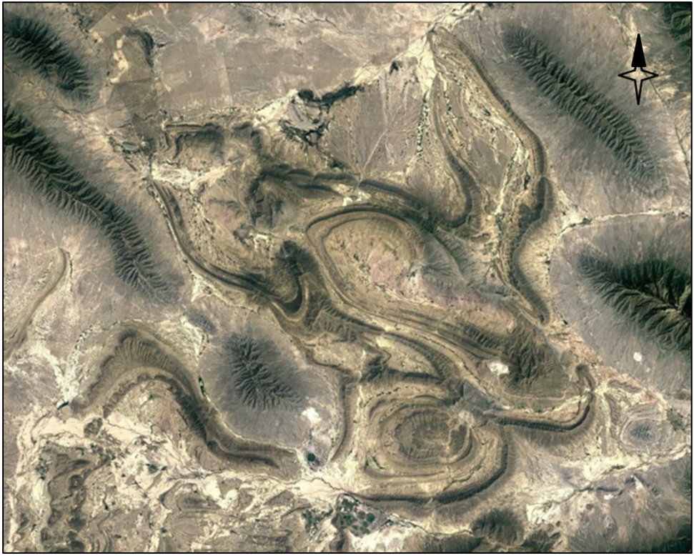
Fig. 14 - Eagle Geoglyph - Compass position26.137894, -100.815518, Google Maps.
If you compare the angle and position of the Eagle Geoglyph, it is at a similar angle as the Pyramid of the Sun and the Pyramid of the Moon in Central Mexico.
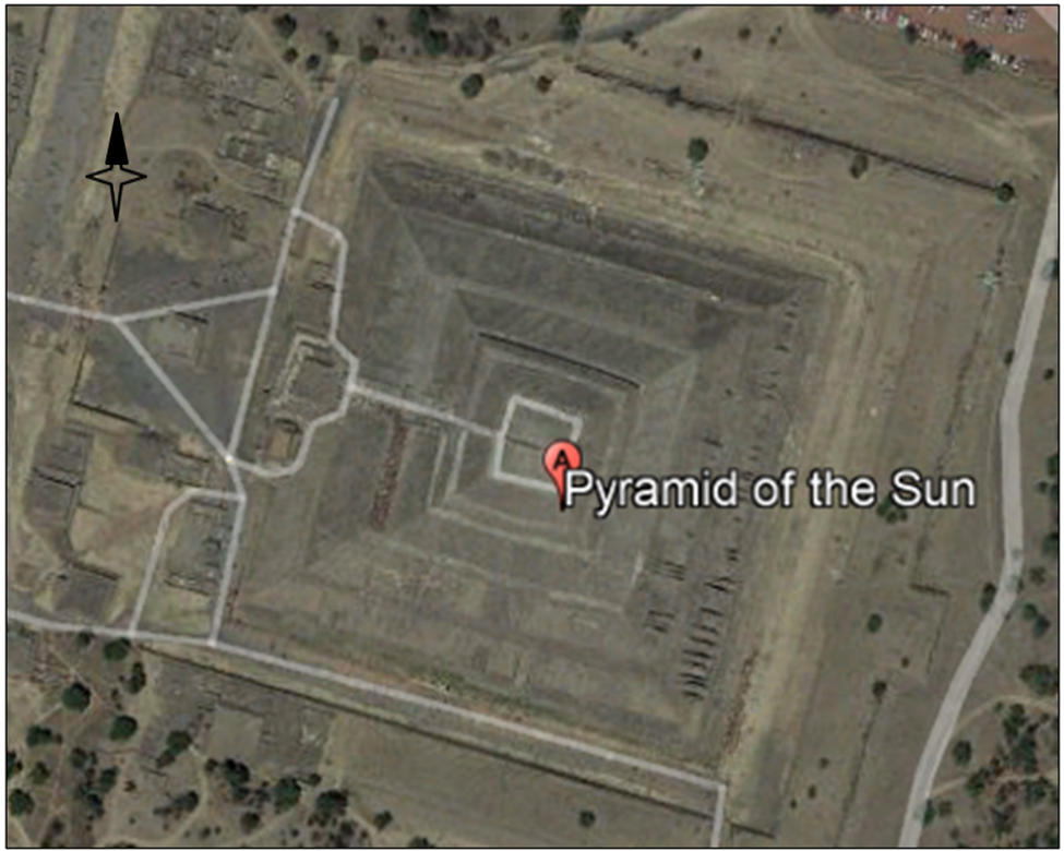
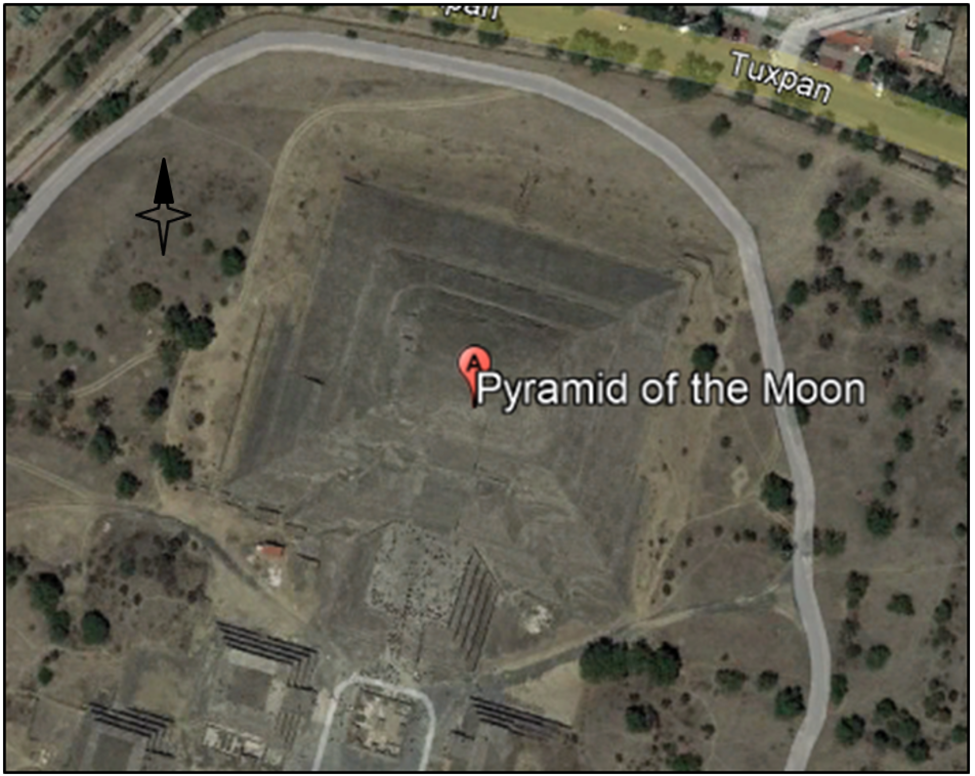
Fig. 15 - Pyramid of the Sun, San Juan Teotihuacán, State of Mexico, Mexico, 19.692421, -98.843628, Google Earth.
Fig. 16 – Pyramid of the Moon, Tuxpan, San Martín de las Pirámides, State of Mexico, México, 19.6996965, -98.8439207, Google Earth.
Local Settlements and Archeology
A few small settlements and towns exist in and around the Eagle Geoglyph, with narrow roads that can be seen on the Google map. Some of the names are San Jose de la Popa, Carricitos, La Carroza “carriage,” LaPopa, Los Remotos, Bustamante, San Francisco, Icamole, Mina, El Milagro “the miracle,” Vacas “cows,” Paredon “thick outer wall,” Cadillo ‘bur”, and San Antonio de Arista “Saint Anthony of the edge.” One town, Espinazo, is said to be a site of many miracles. A long high solid cliff site called El Puerto San Bernabe, may have been named by the Spanish after a similar location near Burgos, Spain, called Ermita de San Bernabe. This Mexican geographical name is Cuchilla San Bernabe, which translates, “blade of Saint Barnabas.”
Ancient rock petroglyphs can be seen at the archaeological sites such as Boca de Potrerillos and Canada El Marron “ravine of brown”. There are rock formations named Cerro del Muerto “Hill of Death” and La Aguja Inferior “the lower needle,” located there. The high promontory of El Paplote, which translates “the kite,” appears like an arrow point under the eagle’s right wing at the elevation of 5,705 feet and a height of 5,577 feet above the basin. This is also named El Gavilan which translates, “the hawk.” A dried lake, Las Esperanzas, which translates “to give hope to,” is located on the southwest side of the geoglyph.
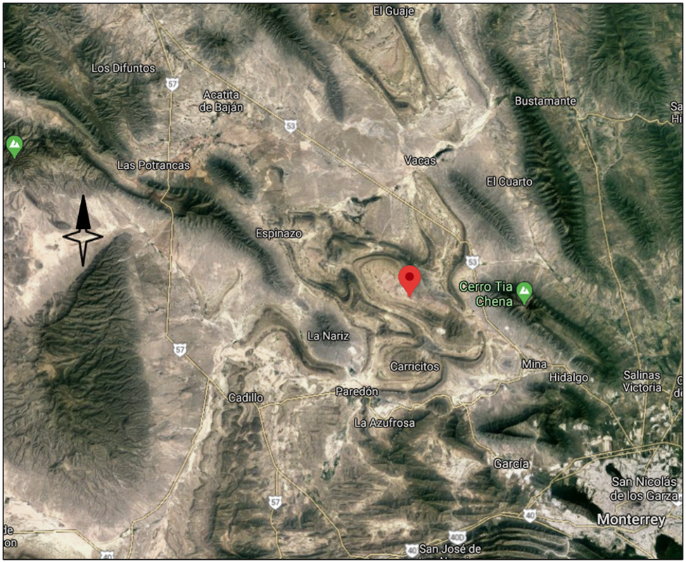
Fig. 17 - Eagle Geoglyph – Location Coordinates 26.137894, -100.815518, Google Maps.
Sierra el Rincon del Arco ‘bend in the river bow” is the ridge of low mountains that make up the top of the right wing of the eagle. It is at an elevation of 3,438 feet. The Sierra el Cantrisco and Sierra el Lantrisco mountains make up the top and side of the eagle’s head. The Sierra el Maneadero “of the spring” and Sierra el Colorado “of the red” mountains make up the top of the left wing.
Surrounding this geoglyph basin, there are thirteen more elevated mountain ranges. The Sierra El Zapatero “cobbler” and the Sierra Los Guajes “gourd” mountains are to the north. The Sierra De Enmedio “middle”, the Sierra Gomas mountains, and the Sierra Minas Viejas, with the high peak of Cerro Tia Chena, are to the east. The Sierra El Fraile, with the prominence of Picachos el Fraile, and the Sierra San Miguel mountains are to the southeast. The Sierra El Cedral and the Sierra La Azufrosa “Sulphureous” mountains are to the south. The Sierra Pinta, the Sierra Chata (part of the cactus pattern), and the Sierra De La Gavia “topsail” mountains are to the west. The Sierra Azul “Blue” mountains are to the northwest.
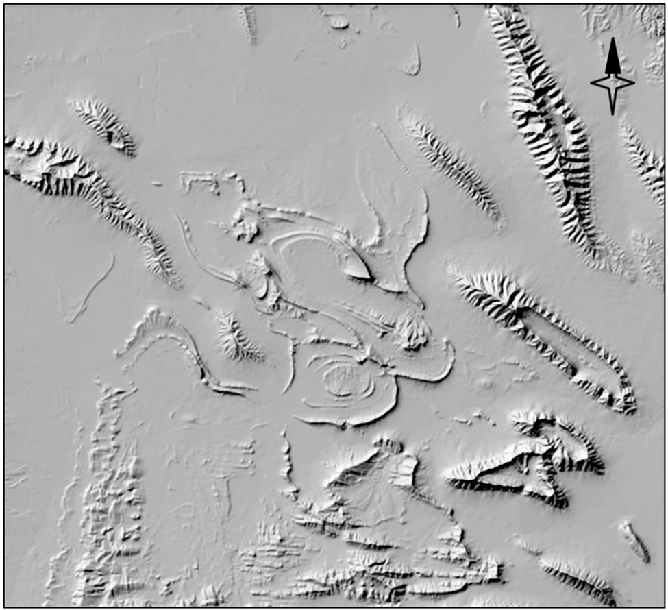
Fig. 18 - 3DEP Elevation – Hillshade Stretched, Nuevo Leon region, USGS The National Map.
Symbology
WithinThe Essential Mendoza Codex,there are drawings and paintings of “Speech Scroll” symbols. These are portrayed with irregular patterns coming from the region of the subject’s mouth.
In various other Aztec Codex publications there are drawings of deer, burros, and jaguars that have speech scrolls with different patterns for each animal.


Fig. 19 - Speech Scrolls, Father of Two Youths,
Folio 61r, The Essential Mendoza Codex.
Fig. 20 - Speech Scrolls, Teacher,
Folio 61r, The Essential Mendoza Codex.
To extrapolate, perhaps there are similar symbols formed above the eagle’s head?
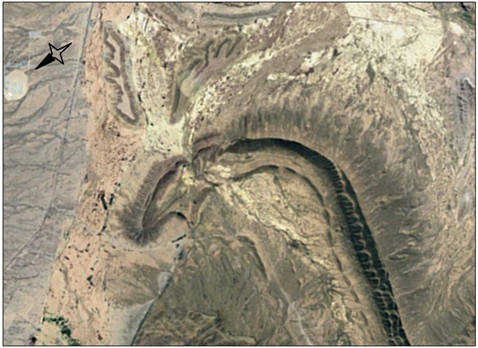
Fig. 21 - Eagle's Head - Rotated 125 degrees to be upright, Google Earth.
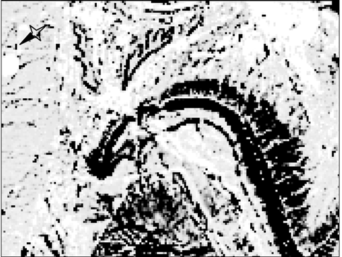
Fig. 22 - Outlined Using Adobe PhotoShop, J. White.
There are two mostly flat in elevation, irregular shaped areas above the Eagle Geoglyph's head. Both patterns are contoured, with one 700 meters or about 2,297 feet at thehighest level. They measure approximately 3.5 kilometers long by 1 kilometer wide. Could these be Aztec eagle speech scrolls or expression symbols?
Conclusion
TheEagle Geoglyph has been here a very long time.
Having been asked who or what created this Eagle Geoglyph, my answer is: “I would not know.”
There is a saying: “There are no coincidences.”
Reviewing these geological structures and these geographical names of this isolated part of Mexico has been enlightening. There are many questions to be answered. Now is a good time for thought and reflection.
What is your answer?
Copyright © 2019 - 2023.
ALL RIGHTS RESERVED.
ANCESTRY TREE
of many Lost, Stolen, and Adopted Native American Children
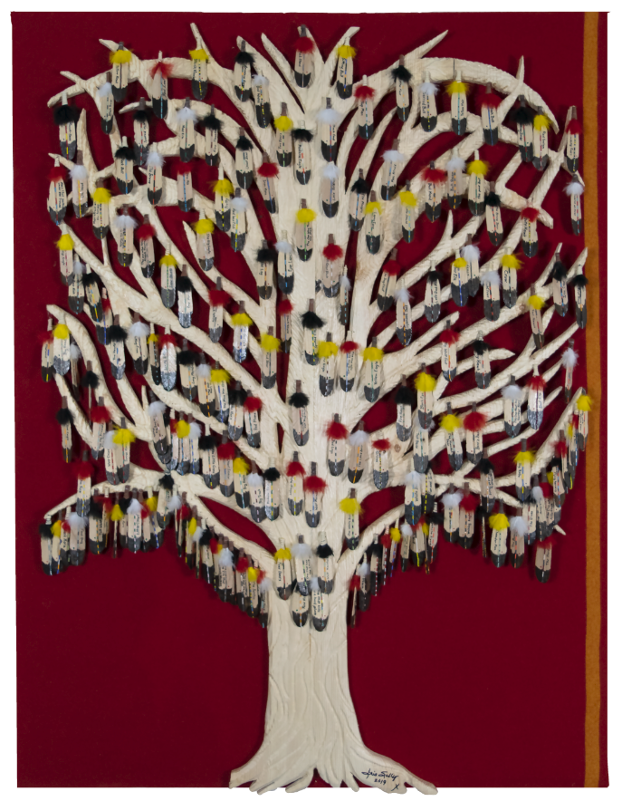
Fig. 24 – "Standing Strong" by Iris Stanton Sully, carved relief sculpture
made from pine, trade cloth, feathers, and beads. H 54” x W 41 ½” x D 3”.
Donated as TBM.2022.30 to The Brinton Museum, Big Horn, Wyoming, by Judith Esparza White.
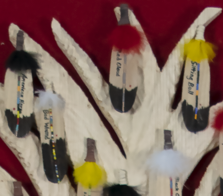
Fig. 25 – "Standing Strong" section with
Sitting Bull, Red Cloud, Bad Wound, & American Horse represented.
The “Articles of a Treaty” at Fort Laramie, Dakota Territory, on April 29, 1868 lists the signers from the Brule band, Oglala band, Minneconjon band, Yantonais band, Hunkapa band, Blackfeet band, Cutheads band, Two Kettle band, Sands Arch band, and the Santee band of Sioux, and the Arapahoes, which creates a tree of the ancestors of many lost, stolen, and adopted Native American children.
https://www.nativecairns.org/projects/leap/articles/articles1868fltreaty.html
PHOTO GALLERY
These Google Map photographs were taken in the same region.


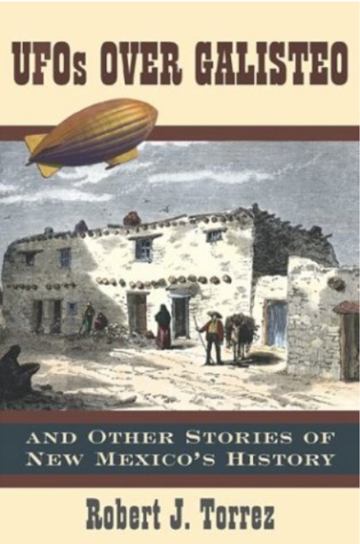
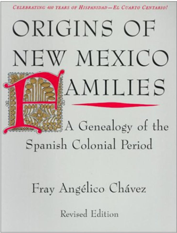
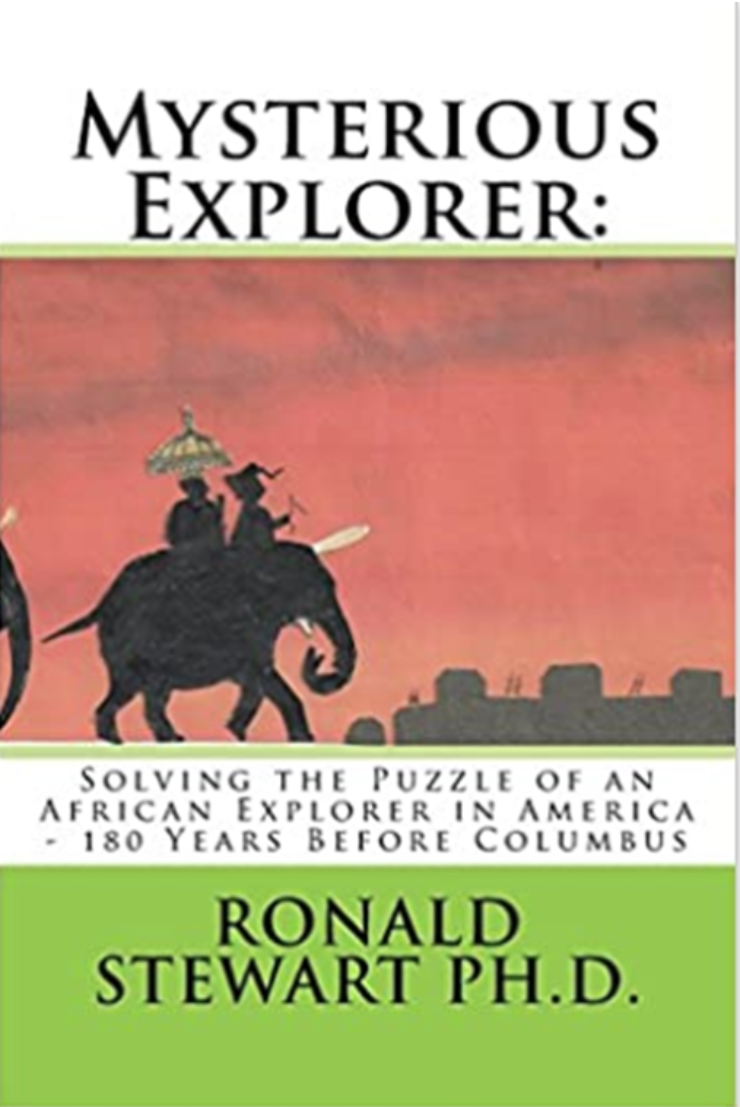
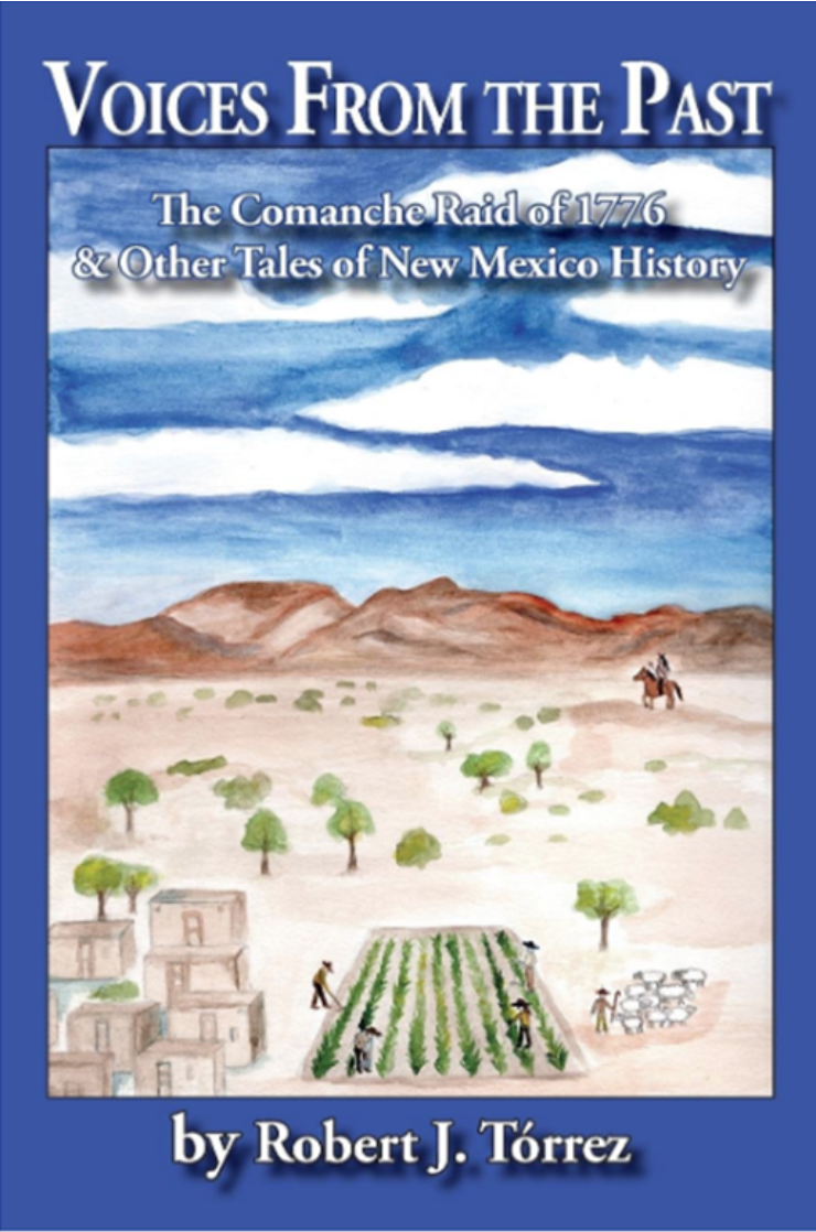
BOOKS
This is a collection of books on subjects related to this area of interest.
CONTACT
If you have comments, please fill out the form
or send an email with your information to
Comment@JudithWhiteGIS.com